The Greenland Series Vol.1
Log 00325
WEST GREENLAND, Disko Bay South
The world’s largest island, Greenland, is renowned for its lush greenery, despite being covered by an icecap that spans across 80% of its surface. Embarking on three provisional expeditions to explore Greenland’s western fjords, we were thrilled to once again delve into the full spectrum of her natural wonders and venture into new territories, including the vibrant communities deriving from an extraordinary whaling culture over the last century. In addition to whale watching, kayaking, rock climbing and multiple hikes, our intended plans were subject to a lot of bad weather… starting with our intended departure from Iceland.
Passage from Iceland to Greenland
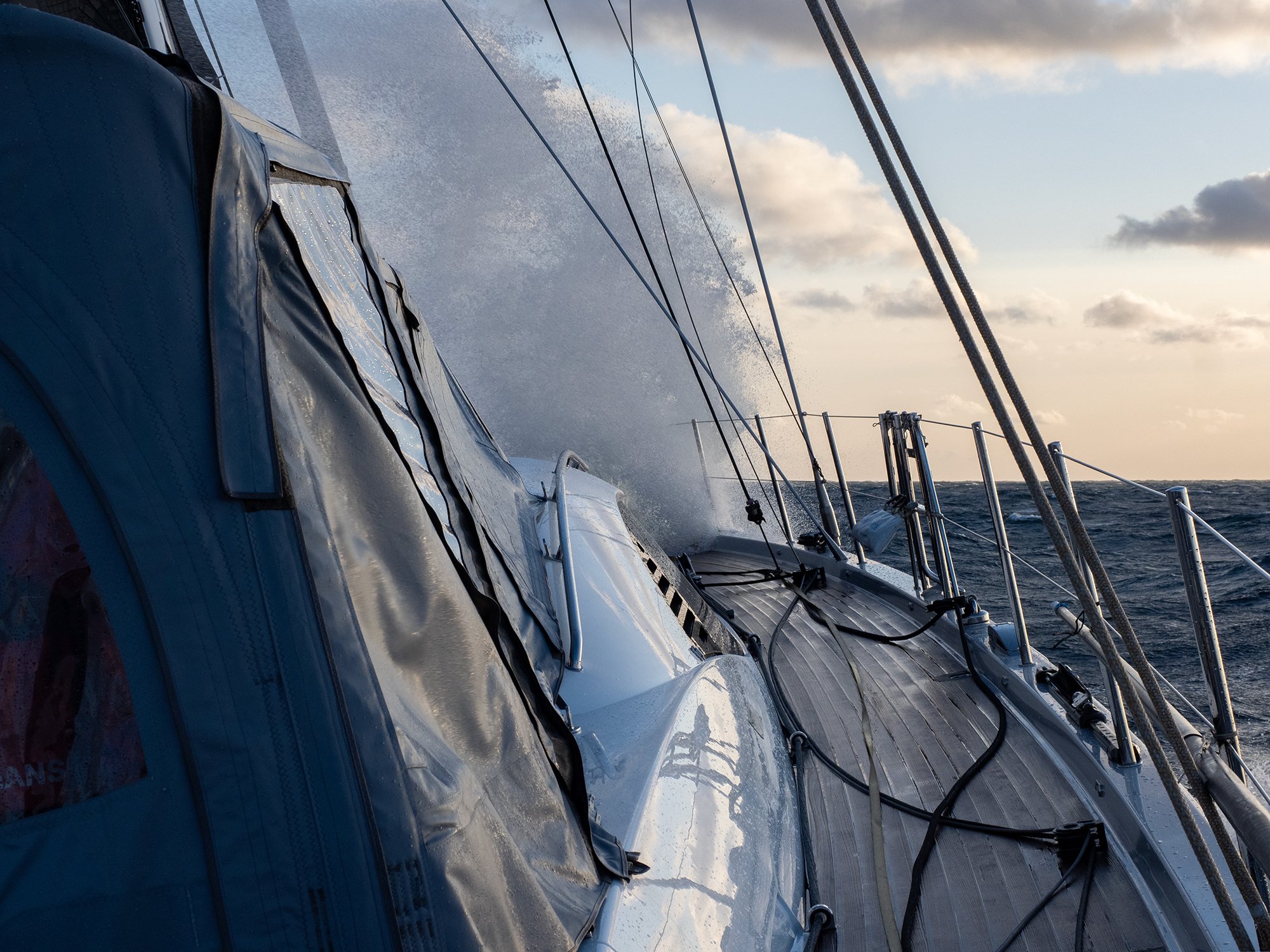
Our departure from Reykjavik was somewhat delayed, thanks to a severe storm covering all of Iceland and essentially freezing us to the dock with gusts of 50+ knots! A feasible departure a couple of days later allowed us to proceed. Carefully charting a course between some residual and unpleasant-looking cyclones, we motored off boldly into the night. The following afternoon, with a third reef in our main and a generous northwest breeze, we flew a brisk course towards the eastern coast of Greenland staying 250 miles north of the Cape Farewell. This was sadly to be followed by a very challenging passage around the Cape Farewell, with some cruel weather forcing us to bear east and off-course, thanks to a piece of the polar climate’s ‘sea ice cover’ reaching further east than had been forecast. Unable to make much headway, changing tact, we headed further seaward losing our favourable wind angle; only then to be hit with 25+ knots almost exactly on the nose!
Mercifully, after a bumpy entry into Greenlandic waters, the winds died down and some calmer seas saw us finally round the Cape in some genuinely pleasant weather, in addition to some bizarre masses of ice floating alongside. Removing a wounded running staysail and in a bid to avoid the gusty and unpredictable southerly coastal winds; we maintained a course 80 miles offshore to reduce any potential encounters with these unworldly masses of ice! Passing Greenland’s most southerly point had been a treacherous route, with our view of the Cape itself unfortunately obstructed by mounds of ice and poor weather. Fortunately, there are no further events to report from this initial voyage.
Our remarkable Firebird crew demonstrated unwavering determination and indomitable high spirits throughout the entirety of this journey. From the moment we set sail from Iceland, their resilience and enthusiasm was nothing short of inspiring.
Nuuk – Davis Strait – Aasiaat (Egesdesminde) & Introduction to Kayaking
We were grateful to moor up in Greenland’s capital city and administrative centre, Nuuk (formerly Godthåb), which is located on the southwest coast and still relatively small in size considering it is Greenland’s most densely populated city. Home to a large fjord system, the area is renowned for its humpback whales, waterfalls, and icebergs, along with a stunning coastline embellished with brightly coloured houses, against a backdrop of the 1200m high Sermitsiaq (Saddle) mountains. Making it safely through customs and immigration, we successfully restocked the boat, adding a few provisions to deter any less friendly local bears we might encounter.
From here we headed north and further seaward than was necessary, to avoid a flock of fishermen as well as several resident icebergs. Waiting for an unattractive weather front to pass whilst hiding in a fjord to the north of the Davis Strait, we stumbled across a lovely bay (Pitorsilva) with a river flowing from a small neighbouring lake. Here we happily absorbed some of the most remarkable scenery we had encountered in Greenland yet. The next morning, we awoke to a dry riverbed full of fat, blue mussels! We later gorged on our freshly caught mussels, accompanied lovingly by french fries and a crusty baguette to soak it all up!
Thus far, Greenland had greeted us with consistent grey skies, but when the clouds finally lifted, Mother Nature rewarded us in the most spectacular way. Having been previously veiled in mist, the snow-capped mountains enroute to Aasiaat now stood tall and proud against the backdrop of a stunning azure sky. Distant icebergs glistened like diamonds in the sunshine, creating a spectacle that words can hardly describe. Welcoming this wonderful weather transformation, we soaked up every second.
Renowned as the “land of a thousand islands” (and home to almost as many whales…), Aasiaat is the heart of this archipelago’s less-mountainous isles and is Greenland’s 5th largest town. The rainbow-coloured dwellings are also home to an impressive collection of famous (and less-famous) artwork. We approached Aasiaat along Greenland’s enormous stretch of coastline, passing their many intricate waterways offering shelter to the playful whales, in both the summer and winter months.
Greenland’s largest bay is located on the remote, western fringes of Europe and best known for its endless opportunities for arctic exploration. We collected an old comrade from our previous Svalbard expedition, specialist Arctic Guide, Morten Rostille, who would now be our "Greenland Guru".
With both the Atlantic and High Arctic weather systems heavily dictating Disko Bay’s adverse conditions, it was almost impossible to predict an exact itinerary ahead of our expedition, especially with the considerably ‘late and cold’ spring they seemed to be experiencing! Having been far from kind to us so far, the weather promised a calmer break in the clouds until later that evening. Weighing anchor, we set off from the island’s eastern tip for our first lesson in open water ‘solo’ kayaking, this has been described by many as the best way to get up close and personal with Greenland's wonderful fjords, skerries and icebergs.
Our first session with the kayaks included a three-hour initiation to simply familiarise ourselves with the equipment. With the smallest of swells causing us a lot of grief, the kayaks were narrow and fidgety at first; as well as being difficult to balance or maintain on course! Once finding out balance, there was no denying that this form of exploration was unparalleled. The average water temperature in Greenland’s summer is still only around +1-3°C, so we were very happy to be back onboard post-paddle, for some warm food and a strong cup of tea…
Qasigiannguit (Christianshab) - Laksebugt (Salmon Bay)
The next morning, the weather had settled down as suggested, with a little drizzle and a mere 20 knots of breeze from the southwest. With similar weather forecasted on the east coast, sharpening our knives and preparing our fishing tackle, we headed across the bay. The satellite showed that the ice from the fish-rich lakes had not yet melted as a result of Greenland’s late spring. We used this also as an excuse for another afternoon of fishing, in Disko Bay’s ‘Fishing Capital’! We managed to catch a trio of Atlantic Catfish in the evening for dinner; we then anchored near Qasigiannguit (Christianshab) for the night with the idea of an impromptu hike to Laksebugt (Salmon Bay) the following morning.
With no wind and even some promised sunshine for the afternoon, we planned a hike of around 25 km (FYI the local maps do not specify any relief details and so approximate distance and route predictions are only estimates!). Draped in bewildering and luminous landscapes, this remote part of western Greenland was truly entrancing (minus the occasional debris of empty shells and cartridges, which we noted had not been present back in Svalbard…). We passed an interesting fjord, a couple of picturesque waterfalls, and a slippery massif upon the lake; in some drier weather, it would have made for a very intriguing climb.
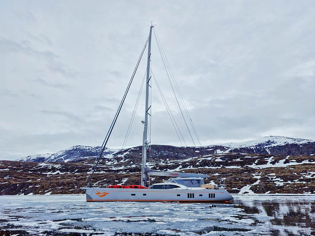
After arranging a rendezvous point within Salmon Bay (thanks to surprisingly good tele-comms in such remote terrain…), we managed to get safely back onboard without undue risk as S/Y Firebird cautiously made her approach through the impenetrable winter ice, into the unknown depths of Salmon Bay.
Believing ourselves to have been blessed with a calm anchorage and even some rare evening sunshine between breaks in the cloud, we celebrated , by taking the opportunity to BBQ some prime steak on our trusty Weber Grill! Unfortunately, as the night drew in, it became increasingly apparent that our not so ‘calm anchorage’ was less protected than first thought… with a number of downfalls such as multiple tidal increases, requiring constant re-anchoring, to avoid becoming frozen in the ice!!! The next morning (with everyone being somewhat deprived of sleep), we managed to snap the anchor chain! And although both the plotter and our visual references gave a good idea of where we ought to find our chain, (a likely 30m below the water’s surface), the task of retrieving it did not seem an easy one!
Marking the suspected area with a weighted fender, we slowly trawled the bay attempting to hook the lost chain, but the rising wind and lack of manoeuvrability at low speed quickly deemed these attempts as futile. After more painstaking efforts and three hours spent in vain, we departed for Christianshab in search of a more efficient trawl. A hearty dinner of beef stroganoff helped prepare us for any further unforeseen events, and raising our spare anchor we moved back to Salmon Bay after dinner. You’ll be pleased to know that with the help of an impromptu ladder… we managed to hook our chain on a later second attempt!
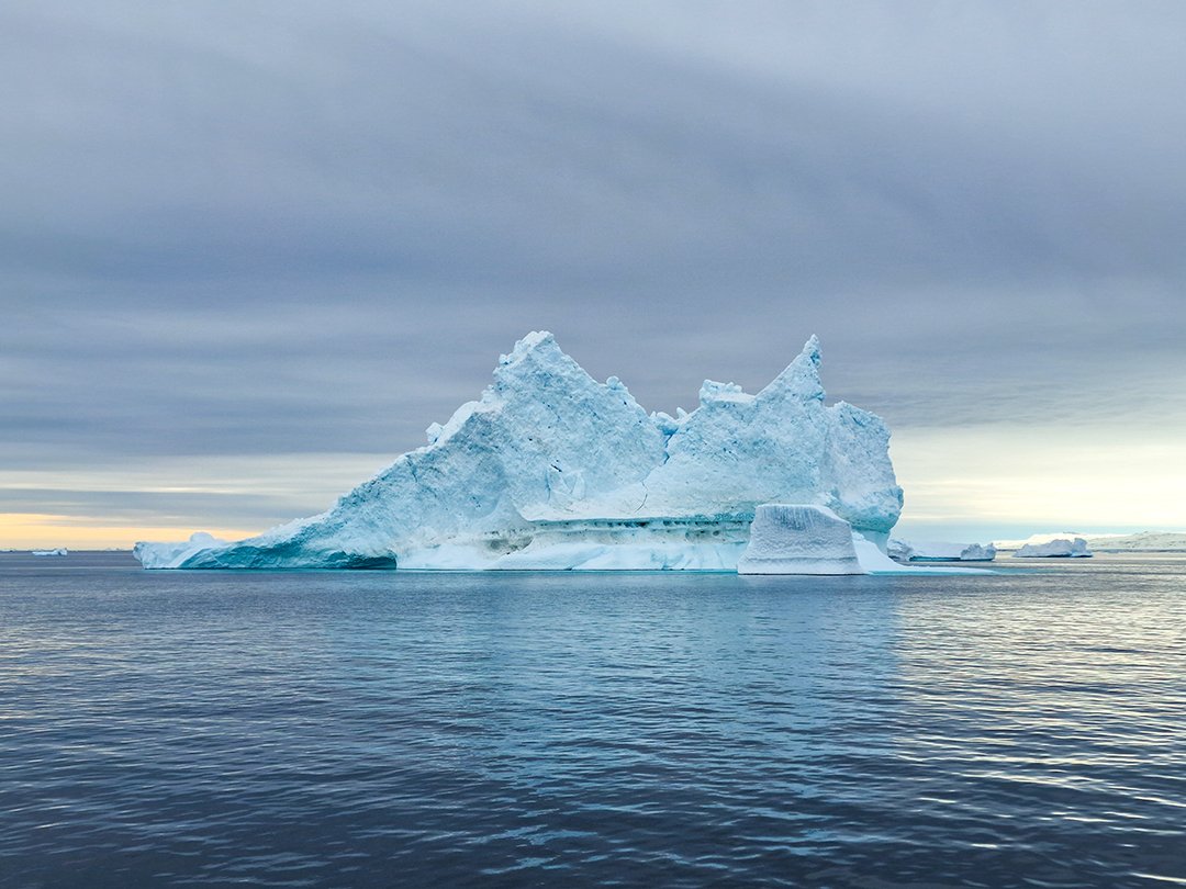
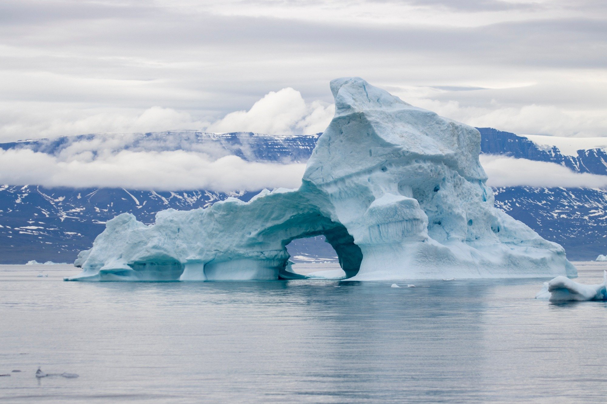
Navigating through the enchanting waters of Laksebugt was a unique journey to another world, especially with such dramatic skies above us. This hidden gem boasted colossal icebergs peacefully drifting through glassy waters.
Fortune Bay
Huge, lonely icebergs and local fishermen were the only distractions from a beautiful sunset and dawn rise on our night transition to Fortune Bay (Killiit); which by the way, is considered to be one of the most beautiful anchorages in the northern hemisphere…
Our entire passage and entrance into the cosy and windless bay was clogged with drifting ice floes, requiring our utmost attention especially with the addition of its narrow entry and several unpleasant banks. It took almost two hours to squeeze Firebird through the tricky strait before reaching the Bay of Fortune (often referred to as the Bay of Destiny). With another surprise ahead, we found that half the bay was still bound by winter ice. A couple of healthy sized, non-local icebergs were also present, most likely brought here by the storm’s westerly winds the previous week. It was obvious that we would not be getting much sleep here either, given the necessity for a permanent ice watch. Throwing bait for good luck, some crew morale was lifted when both a small catfish and local flounder took almost immediately!
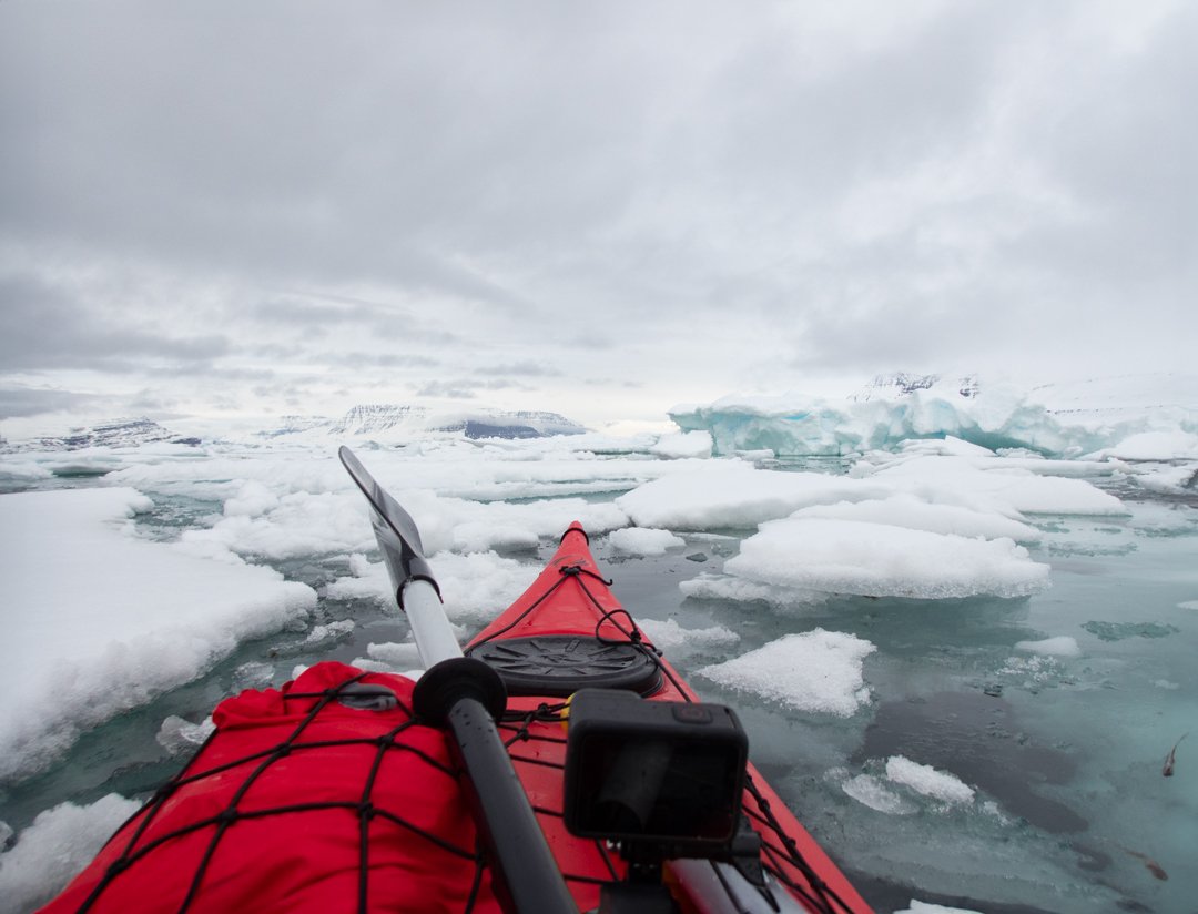
The following morning, we briskly launched our kayaks and headed back out of the bay, nudging through the narrow channels towards the open water. Enormous icebergs mirrored onto the glassy surface; and as we ducked below their towering walls of ice, they appeared like fluffy clouds above and below the surface. Keeping our wits about us with the unpleasant prospect of a potential capsize, we steadily slalomed our way back into the bay along the main passage… and here, amidst such incredible beauty, we were lucky enough to catch a glimpse of whale fin!!!
Kangerluarsuk Fjord – Disko Fjord
Prior to our entry into the Kangerluarsuk Fjord and having been assured that it would be virtually free of ice by now, we hadn’t given much thought to potential adverse ice conditions. When faced with large, flat, frozen lily pads still resting leisurely upon the water’s surface, another slow and cautious navigation of no more than 2 knots was required.
Once safely inside the fjord with S/Y Firebird anchored on its eastern side, we headed ashore to embark on a highly anticipated trek along the coastal section of peninsula 3-B.
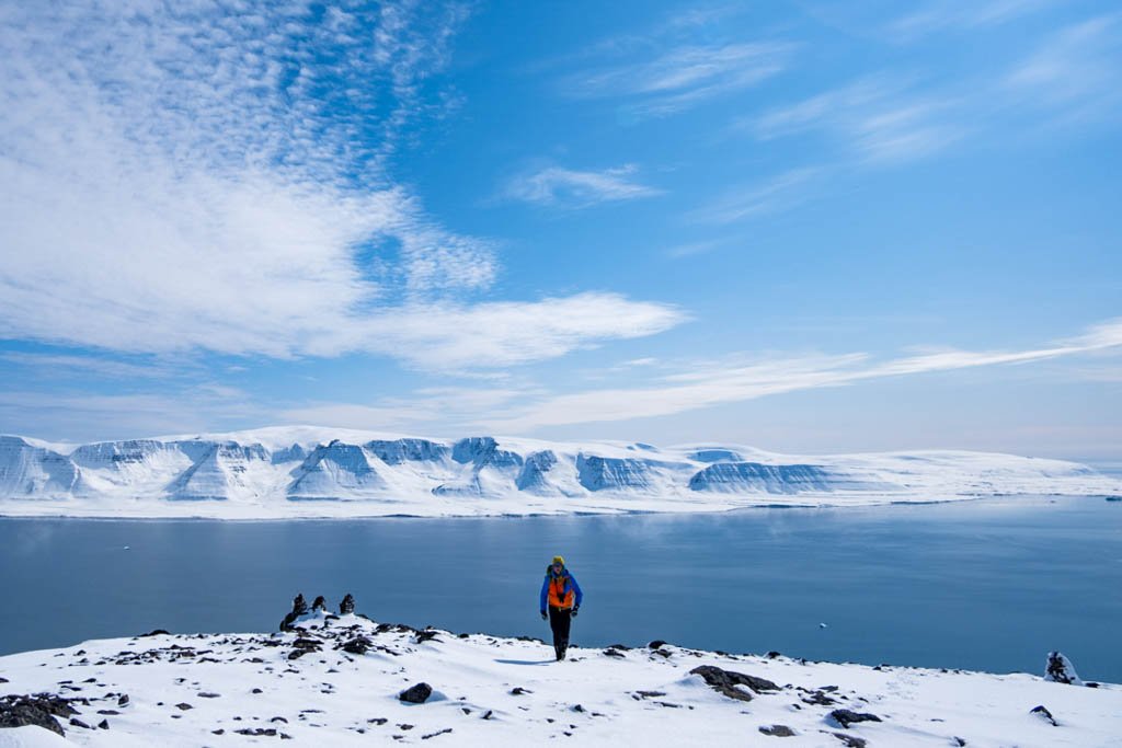
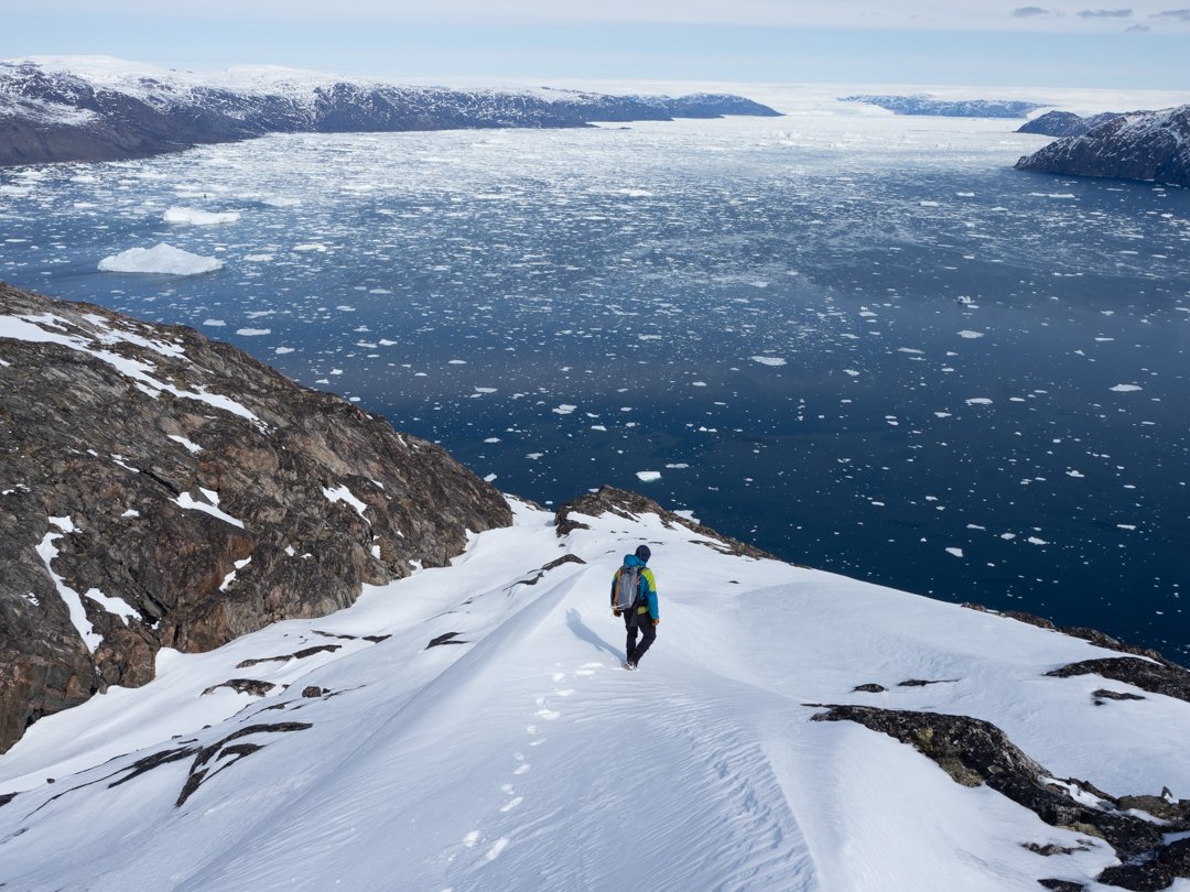
With a lot more winter snow still present than we’d be led to anticipate, we began our trail up the 3C3 slope in some less than ideal, wet, knee-deep, and slushy summer snow. But wow! The 600m and 760m peak views were undoubtedly worth it! Bearing more resemblance to Svalbard than what we’d seen in Western Greenland so far, we endured an arduous descent, sinking into waist-deep snow every 20-30 steps. We were eternally grateful to reach the dry rocks at around the 300m mark, before an unexpected gaggle of geese accompanied us almost the rest of the way back to the boat. The amusing sounds of their displeased cackling insinuated that we had broken their siesta with our intrusion!
Kayaking in Kangikerlak
Having already witnessed some breath-taking scenery on our journey into Disko Island’s fjords, we had an increasing appetite for more. As per guidance from several navigational sources, an extraordinary delta within one of the island's inner fjords known as Kangikerlak, was well worth a visit. Meandering across the entire island before reaching the most eastern point, this delta was now firmly on our agenda.
Believing to have located the delta correctly, we positioned ourselves as close as possible to the river’s flow, launching our kayaks in anticipation of the supposed beauty which lay ahead. Unfortunately, this was short-lived… and after we’d battled the surf, struggling against the river’s hefty flow, we ran into muddy ditches, dragging our kayaks along riverbanks, instead of rowing them upstream as we had hoped! Postponing our assignment to another day with higher tides, we played about in the chilly labyrinths of the western winds’ ice fields. Nipping between floes of ice and bizarre frozen figures, we found ourselves in a bemusing winter wonderland of our own!
Qeqertarsuaq (Godhavn Bay)
Bidding farewell to the Disko Fjord, we began our return to Greenlandic "civilization", with the ice beginning to thaw and loosen. Remaining vigilant, we were glad to return to a normal cruising speed on our approach to Qeqertarsuaq (Godhavn Bay). Local whalers founded ‘Godhavn’ in 1773, but the locals assured us that traces of settlement were found up to five or six thousand years ago, most likely to have been the paleo-Eskimos wandering south.
Qeqertarsuaq town was quick to impress, brimming with distinctive character and charm. Protected on every side from prevailing winds and offering a deep natural fairway, made it a memorable haven for any vessel. We particularly enjoyed the quintessential Nordic-style church, the University of Copenhagen's Polar Station; and a Friday night spent observing the local fishermen prepare their boats for some fair weather fishing the following day.
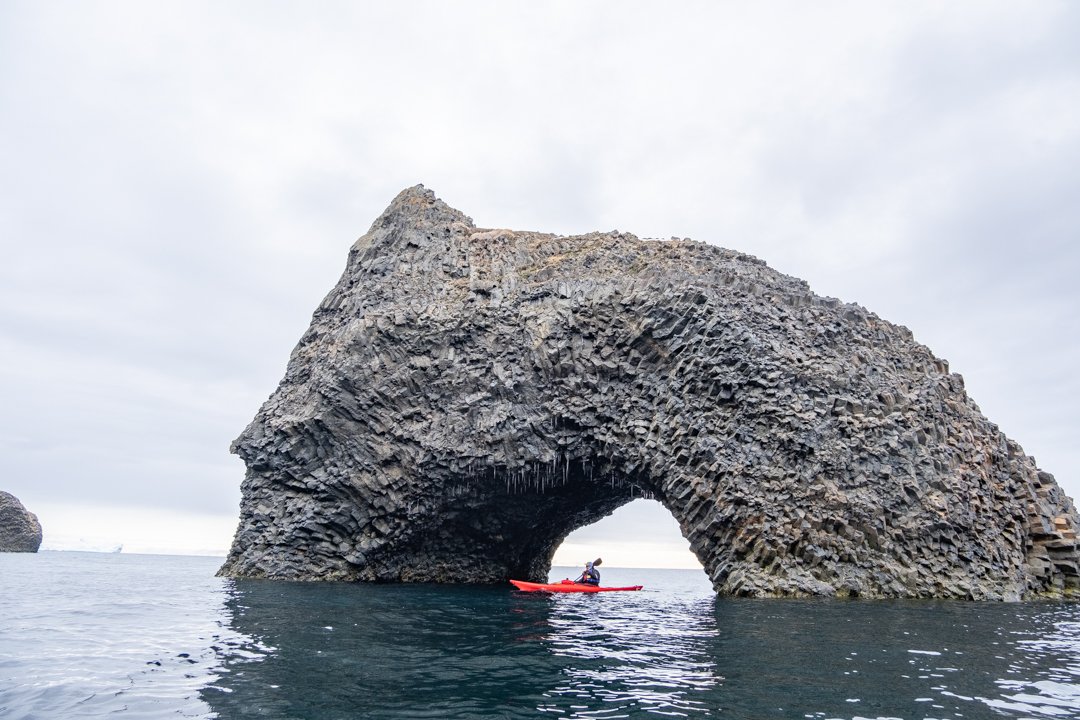
After some failed fishing attempts of our own, we decided to paddle around the remarkable geological wonders surrounding Godhavn. Somewhat similar to Northern Ireland’s ‘Giant Causeway’, the bizarre shapes, textures and formations of these marvellous rocks were presented in a vertical plane and on a larger scale. Kayaking through intricately decorated stone altars, arches, grottoes and past waterfall after waterfall, we ended up rowing through 10km of endless amusement park, with unexpected twists at every turn!
Eqip Glacier
The second largest within the bay and lying east of Disko Island, Arveprinsen Eijland divides the strait into two branches: the navigable west side and the less navigable east side, which is almost always clogged with ice from the Eqip Glacier that feeds it. Satellite images had shown that similarly to the island’s north-western tip, the peninsula and adjacent islet were relatively free of snow, which meant that we were ready to climb!
We mapped a hike spanning east to west across the peninsula’s three primary peaks, with the hope of obtaining exceptional views from the Sermia ridge, of the vast yet rapidly receding Eqip Glacier. A challenging path had us descending unexpectedly between the hills on three occasions, with the map giving little idea of our downward gradient or what might await us at the bottom. Thanks to the initial sunny, clear skies, we experienced several bewitching views of the 4km wide and 200m tall glacier. With fatigue now taking its toll, our challenge was amplified upon reaching the third peak, when snow began to fall. Fortunately, as we descended further towards our meeting point, a canyon path led us along the sunny side of the lake, blessing us with crisp, fresh mountain streams to replenish our long-empty flasks.
Oqaatsut (Rodebay)
Moving further south we anchored next to Oqaatsut (Oqaitsut); a small Greenlandic fishing settlement located just north of Ilulissat.
The settlement first operated as ‘Rodebay’ (Red Bay), a trading post for 18th-century Dutch whalers. Eerily, due to a previously prominent whaling trade ‘Red Bay’ derives from the transformation of water colour, from cool blue to rusty red. Today there are now stringent laws in place which prohibits most whale hunting in Greenland, but on clear days you can still see the bones on Rodebay’s ghostly seabed dating back to the 18th century.
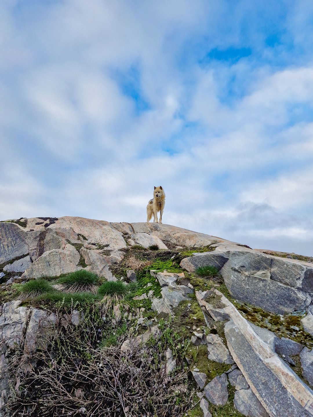
Today it is home to less than 50 inhabitants, offering a single, all-purpose ‘Pilersuisoq’ store and lacking much else in the way of commodities, except for the local church which doubles up as a local school. Village life here is focused on sustaining a small community that loves to be close to the sea. Between the few coastal houses scattered across the rocky terrain, we noticed several of the local huskies, which are predominantly used for dog sledding, but often employed as loyal fishermens’ friends.
Albeit a little quiet, with fantastical icebergs on our doorstep and friendly whales passing us by, you can see why we were very happy to sit back and soak up our tranquil anchorage here.
Ilulissat Icefjord - Oqqaitsut
Our journey across Disko Bay allowed us to capture some superb iceberg photography, with some of our most cherished shots taken around the Ilulissat Icefjord. Often visible from the neighbouring town of Oqqaitsut, huge monstrosities of ice lay beyond the rows of pastel-coloured houses. Aptly, Ilulissat’s Greenlandic name translates directly as 'Icebergs', personifying the essence of this special location.
Arriving by boat fortunately brought us within metres of these astounding sculptures, complimented further by the sounds of whale blows and howling sled dogs in the distance.
Such sights and sounds amidst Greenland’s dusty skies, remain ingrained forever in our memories!
Ilimanaq (Claushavn) ‘Place of Expectations’
Like many other settlements in this area, the original Danish name ‘Claushavn’ derives from founding Dutch whaler, Klaes Pieterz Torp in 1741. Here in the ‘Place of Expectations’, we took a hike along the Ilimanaq hills, providing us with superb views of the iceberg city within Ilulissat’s Icefjord, and across some artistic rock marbling during our chilly exploration on land.
Making our way back to Ilulissat, where we were due to conclude our exploration of southern Disko Bay, we enjoyed a final morning kayak down ‘Iceberg Alley’ and a panorama coastal walk in the afternoon. Our grand finale for this expedition was topped off with a rejuvenating dip in an Artic Sauna, refuelling our bodies before some exceptional fine dining ashore overlooking the ice-filled bay from The Hotel Arctic.
Departing from Ilulissat, S/Y Firebird made her way back down to Aasiaat in advance of our next adventure further north. From the contrasting serenity of glacial waters before bouts of unexpected and untamed wilderness, we relish our unforgettable sailing expedition in the south of Disko Bay. Our favourite moments include the frosty kayak sessions; up-close encounters with epic icebergs; trekking through snow-draped landscapes concluding with awe-inspiring vistas; and discovering Greenland’s charming fishing towns full of cute local huskies along the way.
Continue reading for more tales of our adventures into the northern end of Disko Bay…

