The Land of Fire and Ice : Visiting Iceland
Log 00324
ICELAND
Departing Norway for Iceland
Concluding our adventures in Norway with some spectacular pulka traversing and powder skiing in the Finnmark Alps. Thanks to some assistance from our shore team in mending a broken forestay, we managed a swift departure for Iceland. With a third reef in the main and able to replace a batten whilst underway, we ventured almost 300 miles north in a bid to avoid some low-pressure spots in search of more favourable wind angles. Marvelling at the icicles now frozen on our bow, amidst the pale blue water and grey skies, we were often blessed also, with bright orange sunsets, keeping spirits high.
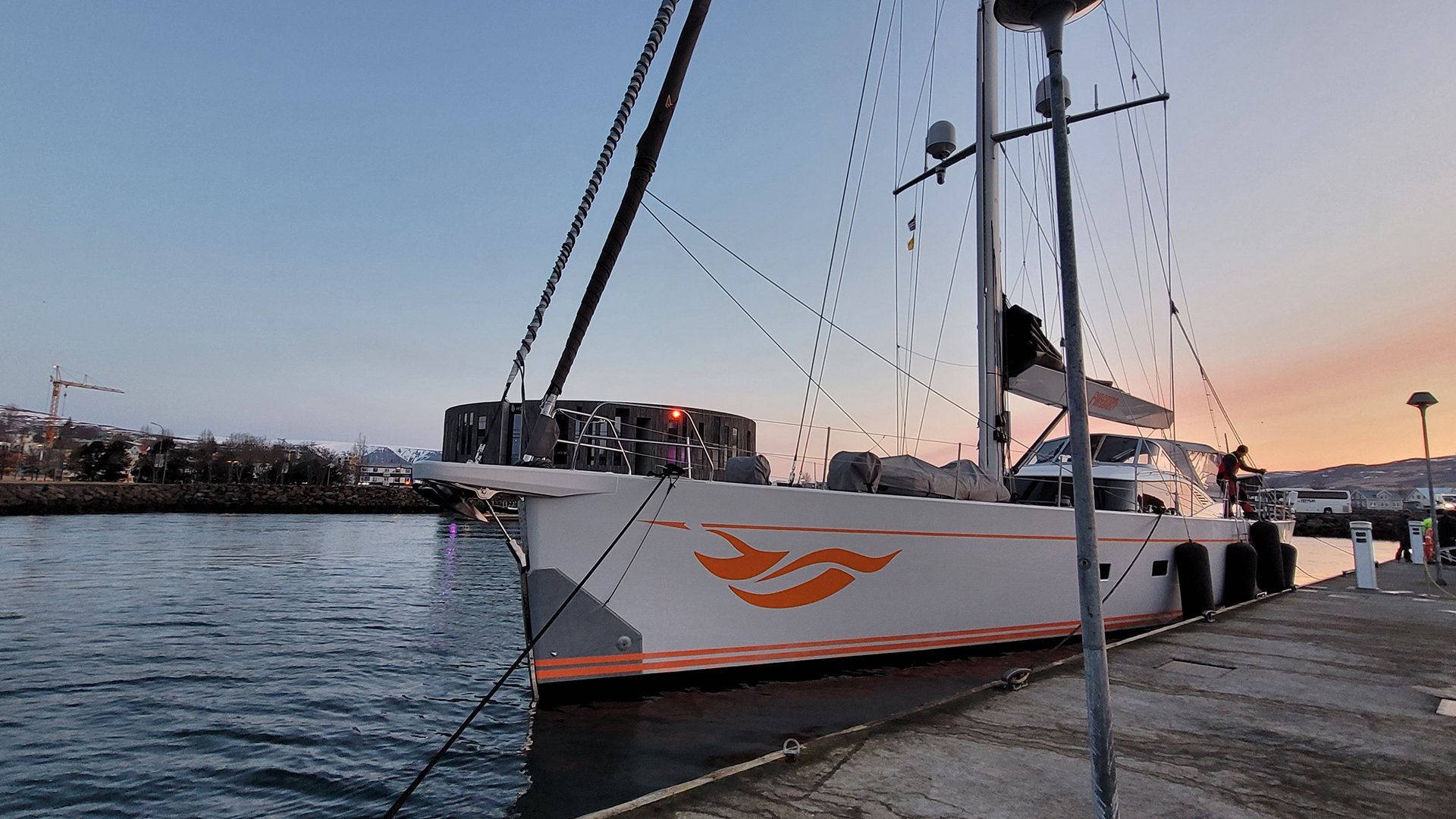
After making the trip , FIREBIRD arrived in the northern town of Akureyri, Iceland’s second-largest city after the greater Reykjavik area. Located at the end of a wide fjord cutting in more than 30 miles deep, the town is built up with multi-coloured, one and two-story buildings, bar the modern and cylindric, Hof Culture House landmark situated on the seafront.
From here our itinerary would take us west, along the north and west coasts before pursuing Reykjavik; We were keen to explore the legendary Icelandic landscapes with a preference for any untouched territory, and looking forward to encounters with local wildlife and of course soaking up the spectacular views!
Akureyri
We allowed ourselves a little indulgence by thawing out in the geothermal Mývatn Nature Baths, often referred to as the aquamarine ‘Blue Lagoon’. The baths draw heat from depths of up to 2,500 meters and are rich in minerals, silicates, and microorganisms (all apparently highly beneficial for your skin)! Sat on top of two diverging tectonic plates, Iceland sees its fair share of volcanic activity, geothermically warming the water under its ground, before sprouting hot springs across several areas of volcanic activity.
From here we met our guide, Beigor, a highly respected and soon-to-be ‘Trawler Captain’. Being a beautiful day, we enjoyed an introductory walk towards the southerly low cliffs surrounding Akureyri, opening up lovely views of the fjord and Iceland’s third largest forest. Locals planted seedlings brought across from Scandinavia and the Canadian coast at the beginning of the 20th century, aiming to enrich their meagre landscape. Since then, Iceland’s forests have been carefully maintained and are now a favourite place for walking amongst the birds nestled between the coniferous and deciduous trees that stand there today.
Godafoss – Skútustaðagígar, Dimmuborgir - Namafjal geysers
Although much less developed by mass tourism than in the south, northern Iceland’s routes are increasingly visited by cruise ships, resulting in a more civilised environment with fenced areas now prohibiting some of the best shots and angles… thankfully we happened to be visiting prior to the peak cruise ship season!
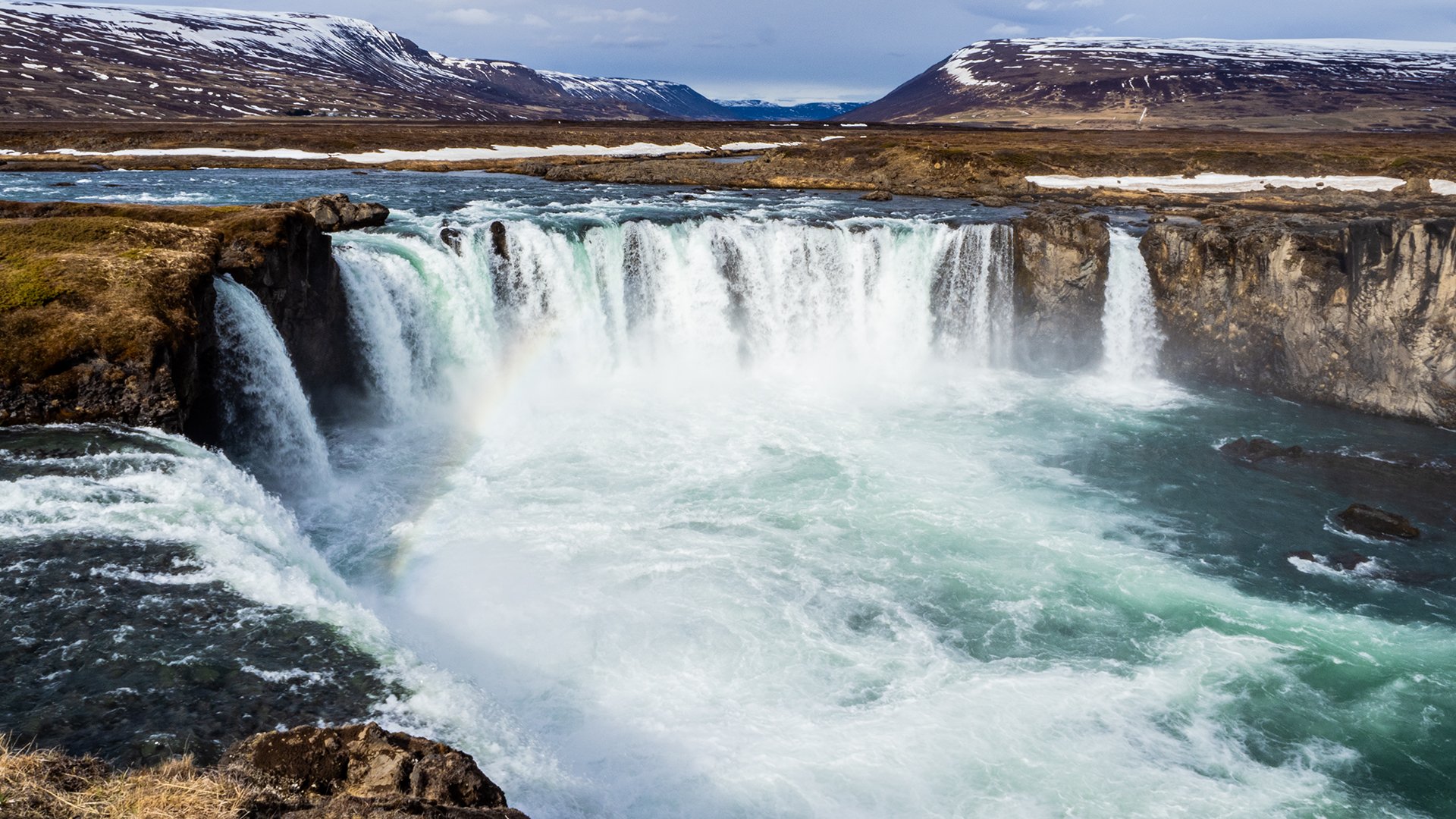
The first point on our route was the Godafoss waterfall (‘Waterfall of the Gods’) of which we took numerous photos from every angle. Cascading down, the water dropped through the overhanging and heavy grey sky, with periodic glimpses of flashing light on the colourless landscape between patches of cloud.
Following this, we ventured to Skútustaðagígar, a curious place whose unique and unearthly landscape derives from its surrounding components of water and lava, producing a row of pseudo craters in the protected reserve wetlands of the Lake Mývatn area. Found in very few places in the world, these phenomenal craters form piping hot thin-flowing lava flows over wetlands or bogs. Boiling the water underneath creates steam pressure that causes explosions and forms clusters of pseudo craters. It also happens to be a hotbed for birdwatching, with various birds found in the craters’ hollows, including 15 species of nesting ducks and occasional sightings of the Gyr Falcon.
Our dedicated photography during our exploration here meant that we had already fallen far behind schedule. A spontaneous decision was made to visit the nearby Efstidalur Farm hotel and restaurant, offering a decent sampling of the local food with their farm-to-table dining. We found ourselves inside a barn with a glass partition, observing their exemplary cattle who were more than happy to pose for our photos. Their traditional and modest culinary offerings were a delight, consisting of mostly lamb and fish.
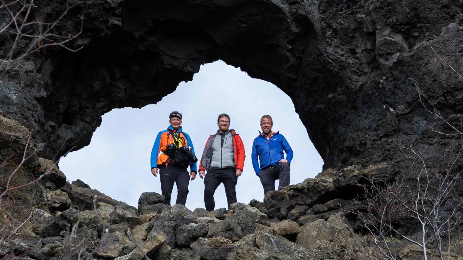
After lunch in the barn, we went hunting for the notorious trolls, supposedly residing in the volcanic caves and lava fields of Dimmuborgir, AKA ‘The Dark Fortress’ (featured as Mance Rayder's camp in Season 3 of HBOs Game of Thrones). The remarkable labyrinth of lava formed over millennia of course molten streams, had sprung pillars of escaping vents of steam. Captivating folklore tales adorn this landscape, including the expulsion of a diminutive troll following some ill-mannered behaviour and accused of stealing the spotlight. Frozen in a disgruntled posture, the troll’s opinion on the matter still conveys today with the universal gesture of his middle finger.
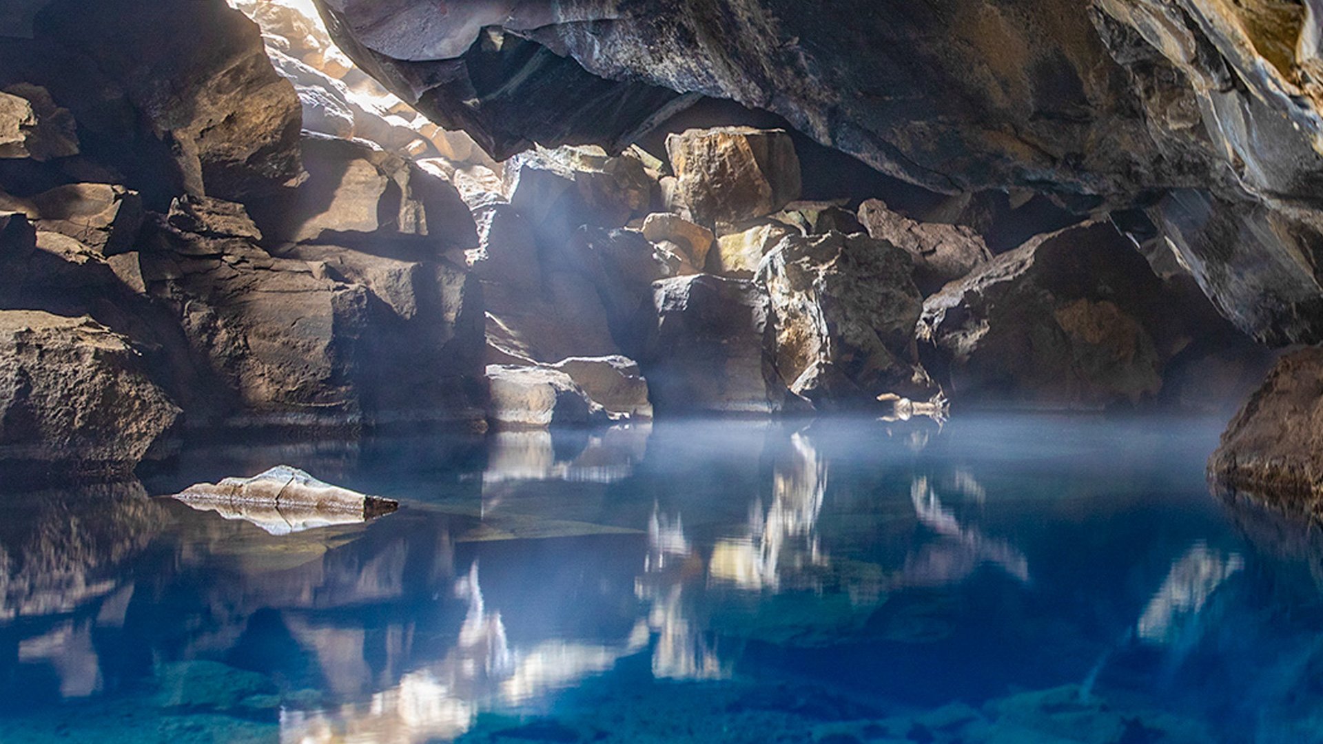
After joyful hours spent hunting for eccentric shapes amidst the frozen lava, the popular Hallarflöt hole provided us with a final picture-postcard moment before heading on to Grjótagjá. The small lava cave of Grjótagjá dates to the early 18th century and was home to Icelandic outlaw, Jón Markússon, the perfect retreat for bandits ostracised by Icelandic Society. Locals frequented the famous hot springs here in the decades that followed, until unpredictable geothermal forces saw the Krafla volcanic system erupt nine times between 1975 and 1984 causing the water inside to boil and deeming the springs unusable to this day. Whilst a little disappointed we unfortunately couldn’t bathe here, we took some fantastic photos instead!
Our last stop, moving gradually closer towards the location of our overnight stay at a coastal guest house on Lake Mývatn, would be the Hverir geyser blast furnace located in the foothills of the Namafjall. Locally referred to as the ‘Rainbow Mountains’ due to being abundant in rich oxides from varying metals, Danish rule exploited a heavy extraction of sulphur, being a principal ingredient in the production of gunpowder. After a very busy day full of history and superb sight-seeing, we dined at the stylish and contemporary Fosshotel, serving some of the finest Nordic cuisine made from Northern Iceland’s local produce.
Dettifoss waterfalls and Asbyrgi Canyon
Our sunrise plans for some early photography on the lake were thwarted by more overhanging, low cloud cover. Instead, we enjoyed a quiet breakfast before setting off in search of the Dettifoss and Selfoss waterfalls ahead of any tourists swooping in. Detifoss is the second most powerful waterfall in Europe after the Rhine Falls and is located on the same river as Selfoss, located a little further upstream. We noticed basalt pillars in bizarre formations on the paths leading up to the falls, presenting analogies with Giant's Causeway in Northern Ireland. A healthy block of ice still residing on the left side of the stream created an unusual contrast between the two states of H2O: a viscous and dynamic flow of water; atop a frozen shell of ice beside deposits of volcanic dust; and the waterfall’s misted spray!
In the afternoon, we took a trail through the Vatnajökull National Park. Deprived of sun for much of the year, the horseshoe-shaped valley of the Asbyrgi Canyon took us by surprise, leaving us with a lasting impression. Filled with dwarf Birch and fairly tall Conifer trees, the canyon’s surrounding basalt walls housed a colony of birds, encircling the transparent and still partially ice-bound lake within its depths.
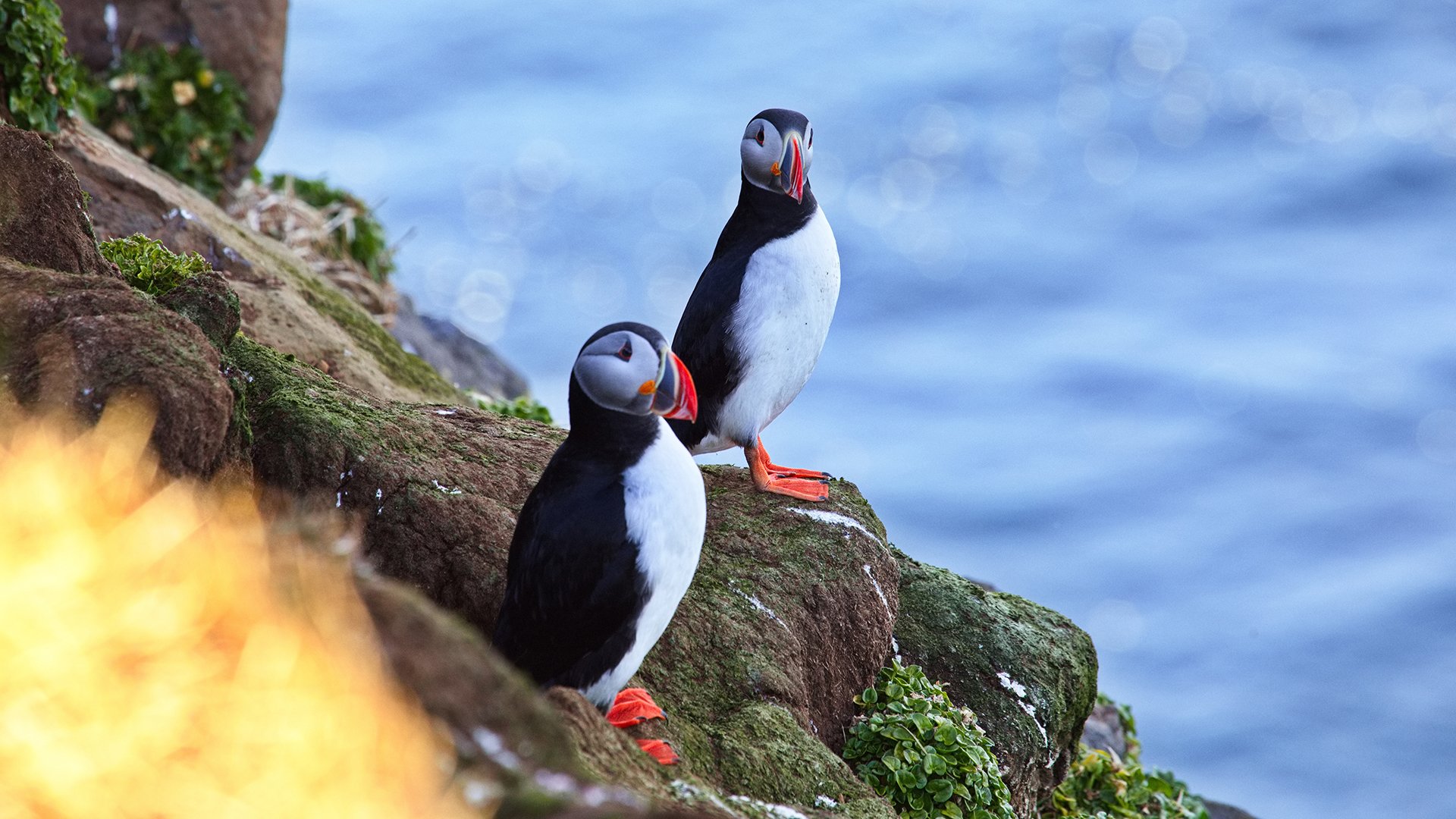
On our way back to the harbour town of Húsavík, we were lucky enough to come across a decent nest of puffins! Thanks to our spectacular telephoto lenses and binoculars, we enjoyed a couple of hours spectating these incredible birds and the way they went about their communal life. Our sightings suggested that much like our own species, particular focuses fell on having an optimum living environment; good relationships with your neighbours; and of course, the bonus of a sun trap balcony when possible!
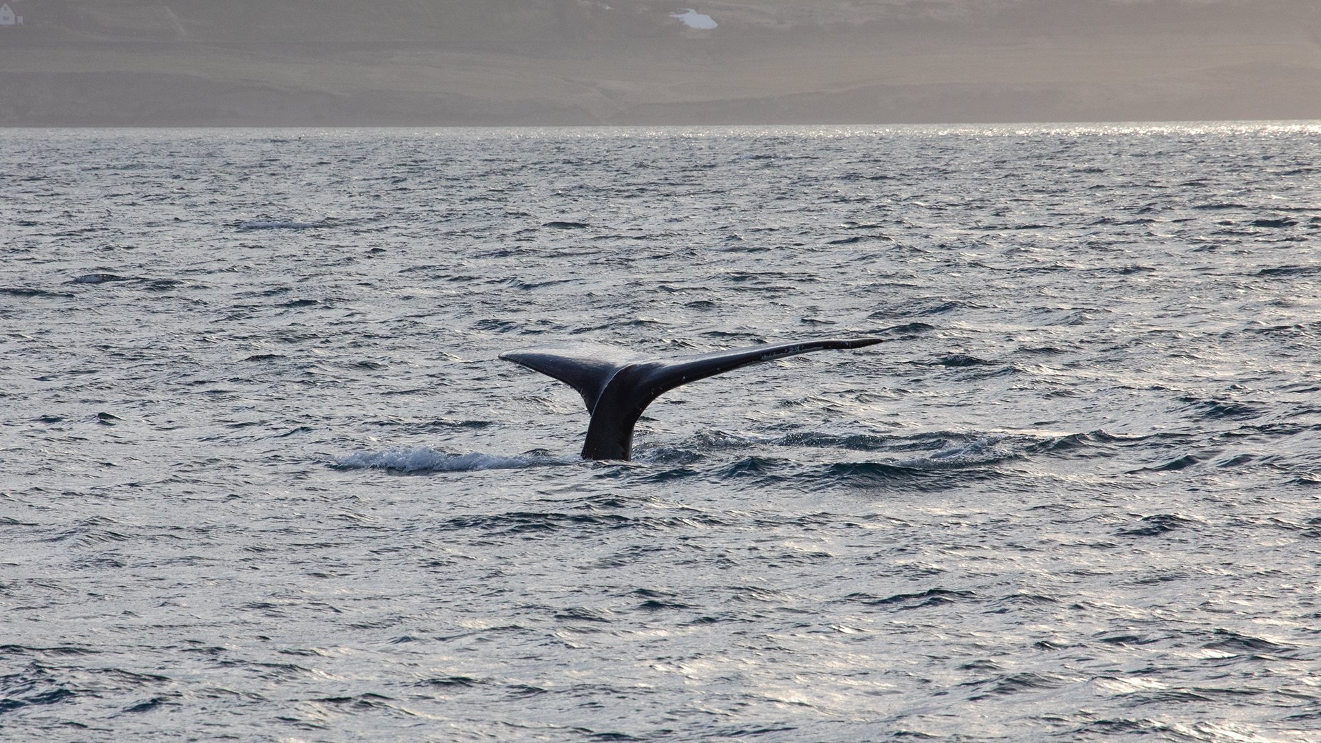
After another eventful day, our evening was gratefully spent in Husavik’s Geosea Geothermal baths, overlooking Skjálfandaflói Bay and the North-Atlantic with fantastic sea views and occasional spotting of whales. The baths’ geothermal boreholes maintain a consistently comfortable water temperature of around 100°F (38°C) throughout the year. The ancient tradition dates back centuries, with the revitalising minerals offering a host of benefits such as pain relief, improved circulation and relaxation. The baths are located on the edge of the Húsavíkurhöfði cliffs 49 metres above sea level, where seabirds flocked around us whilst we peacefully soaked up another fantastic day.
Grimsey Island
Iceland’s adjacent islands and islets offer a perfect nesting and breeding ground for birds, however among the countless variety of those clustering the local valleys and rocks, Puffins and Guillemots seem to have won the monopoly. We imagine that the puffins’ coy looks probably won the others over… and that the guillemots’ brightly coloured and unusually shaped eggs were less likely to accidentally roll down the steep slopes!
Seen far out on the horizon, 40km from the ‘mainland’, an isolated blue cliff sat surrounded by the wide Arctic Ocean. With only courageous fishermen resident here, Grimsey Island is considered to be one of Iceland’s most significant puffin breeding grounds. Their nests are burrowed away in convenient sea facing soft rock. FYI, this makes it incredibly difficult to see or photograph from the land. We were advised that finding breaks in the coastline would be our best bet, ideally between two opposing cliffs for a better chance of observation. This however, was not the only difficulty. Hurrying, we arrived promptly at the suggested scene, keen to get some special shots of Iceland’s cute iconic birds… only to witness the entire colony seemingly take off and disappear out to sea!!! A large number of birds now swayed on the waves about 200 metres below with the rocks now completely empty! Four hours of birdwatching had resulted in zero photos, on an island in which all the guidebooks refer to as: ‘The Island of Puffins’!!!
After a short meeting back onboard, we decided to stay at Grimsey Island, with a second attempt scheduled later in the afternoon. Coincidentally, an updated weather forecast suggested this was wise, given a cyclone now touring in the west meant that there was no point in venturing around to the western fjords just yet.
Our second attempt unfortunately resulted in the same outcome as the first… All the cliffs seemed to be empty! In desperation, we decided to venture around to the other side of the island. Half-heartedly peering inside the rocks, we froze! Alas, a colony of multi-coloured beaks!!! After a good amount of time spent observing these wonderful creatures, we stomped a short distance back along the shore towards the anchorage. As we did, colonies of birds and puffins all began to reconvene, giving us excellent angles and opportunities for the portrait or group shots that we’d been longing for all day.
Good things really do come, to those who wait!!
Husavik
Satisfied with having finally found the puffins on ‘The Island of Puffins’, we headed back towards the mainland, anchoring next to a small and completely flat island in the Húsavík fjord known as Flatey (Flat Island). A charming village with beautiful landscape, Flatey took the top spot for 2020’s 'Best Island in the world' by Big 7 travel! The reason the two-kilometre stretch of land was ranked number one, was down to its unique charm and “movie set” feel!
With a marginally better weather forecast in the north and hoping that the rain and fog might stop at some point, we decided to dedicate our day to fishing before undertaking our long journey to the Westfjords National Park.Our morning of sea fishing proved to be highly successful, with enough cod caught for lunch as well as ample reserves for the freezers. Happy with our lot, we took a car to the lake in the afternoon on the chance of finding some additional rumoured trout… and indeed we did, taking enough for a couple of good dinners and returning content after a surprisingly productive day. After weighing anchor after dinner, we motored off without any wind for sails in some cold and dismal drizzle, heading west towards Hornvvik. A nasty swell from the northeast added to the unpleasantries of this passage.
Hornvvik
The first safe harbour on our approach to the Westfjörds should have been a stunning sight visible for miles and a great opportunity for some ‘once in a lifetime’ shots… but with such a dense fog enveloping the entire coastline, we were simply grateful not to have motored into the cliffs! Located on the eastern shore of Hornvvik Bay and the Hornstrandir Nature Reserve, 500m high Horn Rock (Hornbjarg) is renowned for its majestic and unusually shaped cliffs and burgeoning birdlife. Thousands of Arctic Terns and Black Guillemots nest inside the cliff face, whose eggs were an important food source for residents of Hornstrandir more than 70 years ago (there have been no permanent residents since the 1950s). Men and young boys would abseil down the cliffs collecting one egg from each nest, respectfully allowing the rest to hatch in order to maintain the population.
Unfortunately, the weather disallowed any plans to hike or explore the horn, with nobody keen on an attempt at cod fishing either. This meant that some photography was on the agenda, as well as setting about mending a few minor repairs and other mundane tasks.
A dalvik/Lotravik - Dynjandi
With a dreadful forecast still looming, we conceded early on that there would be no real prospect of any serious hiking or climbing. Having anchored early in Fljotavik, we visited the bay of A dalvik, a hilltop location renowned by the local rangers for spotting Arctic Fox. On exploring a closer look at the typicality of the local mountains, the pretty peak of Hvesta (515m) became visible just to the west of the horn’s highest peak, with its dramatic sheer cliffs dropping steeply into the sea. Densely hung clouds hovered 200-400m above sea level, with bright sunshine up above against a blue polar sky. To our surprise, on our stroll back to tender, we coincidentally stumbled upon four arctic foxes near some abandoned buildings which truly made our day!
Once back onboard, we headed further southwest with our next stop being the 30km long Arnarfjörður fjord, the second biggest within the Westfjörds whose location is famously home to one of Iceland’s most beautiful waterfalls.
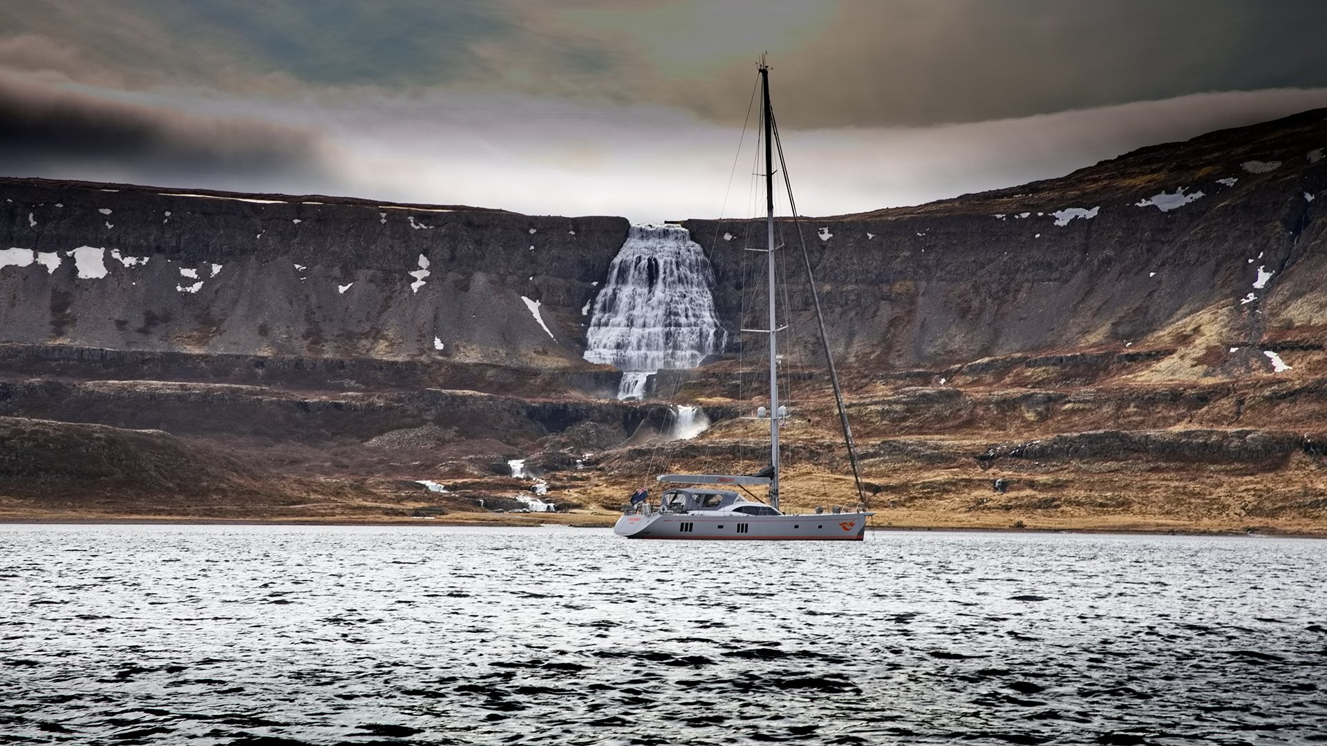
Having anchored in Dynjandisvogur Bay, we can vouch that the waterfall very easily lives up to its grand title, as we marvelled at the breath-taking views of Dynjandi’s main cascade! In fact, we’d go as far as saying that this anchorage was possibly one of the most beautiful we'd ever come across… losing out only marginally to the Marquesas Islands!
Dynjandi Waterfall
The Westfjörds offered a nirvana of waterfalls and having already witnessed several in our exploration of Iceland thus far, we were somewhat sceptical about this particular waterfall being ‘the most beautiful’ of them all!
Our journey via tender was quite an adventure in itself… Exiting the falls, the river’s flow forms a small delta in the bay dividing into various streams; with shallow shoals surrounding the rest of the bay, we deemed the delta as our best route in. Yet, the swirling streams of current within the delta dictated our movements somewhat, washing our tender ashore in places we hadn’t quite planned! Surprisingly, we ended up beached upon a small island with seething snowstorms on both sides, but gained an unexpected vantage point for exceptional shots of the waterfall’s main cascade.
The aptly named, 100m high Dynjandi, translates as "thunderous" and belongs to a series of six other waterfalls below it: Hæstahjallafoss, Strompgljúfrafoss, Göngumannafoss, Hrísvaðsfoss, Hundafoss and Bæjarfoss/Sjófoss. Gazing up at this monumental masterpiece, we were in awe; and as most guidebooks correctly suggest, it is very similar to a bridal veil cascading down the step-like composition.
With the weather deciding it had pampered us enough today, an increasing swell compromised FIREBIRD’s proximity to the rocks. This further dismissed any chances of an acquaintance with the local seals, due to the several-metre high wall of surf now visible on our intended landing point at Rauðasandur beach (Red Sands Beach, which takes its name and colour from pulverised scallop shells).
Day 9 Reykjavik ~ Strokkur Geyser ~ Gullfoss Waterfall ~ Kerid Crater Arriving at Reykjavik allowed us a day of land-based sight-seeing to conclude our wonderful time spent in Iceland. As we surrendered to being tourists for the day, we set off from the ION Adventure Hotel in Thingvellir National Park, starting our day with an easy walk through the fissure to Öxarárfoss waterfall and a visit to the ‘Þingvallakirkja church’ before attending to a few more worldly wonders later that afternoon.
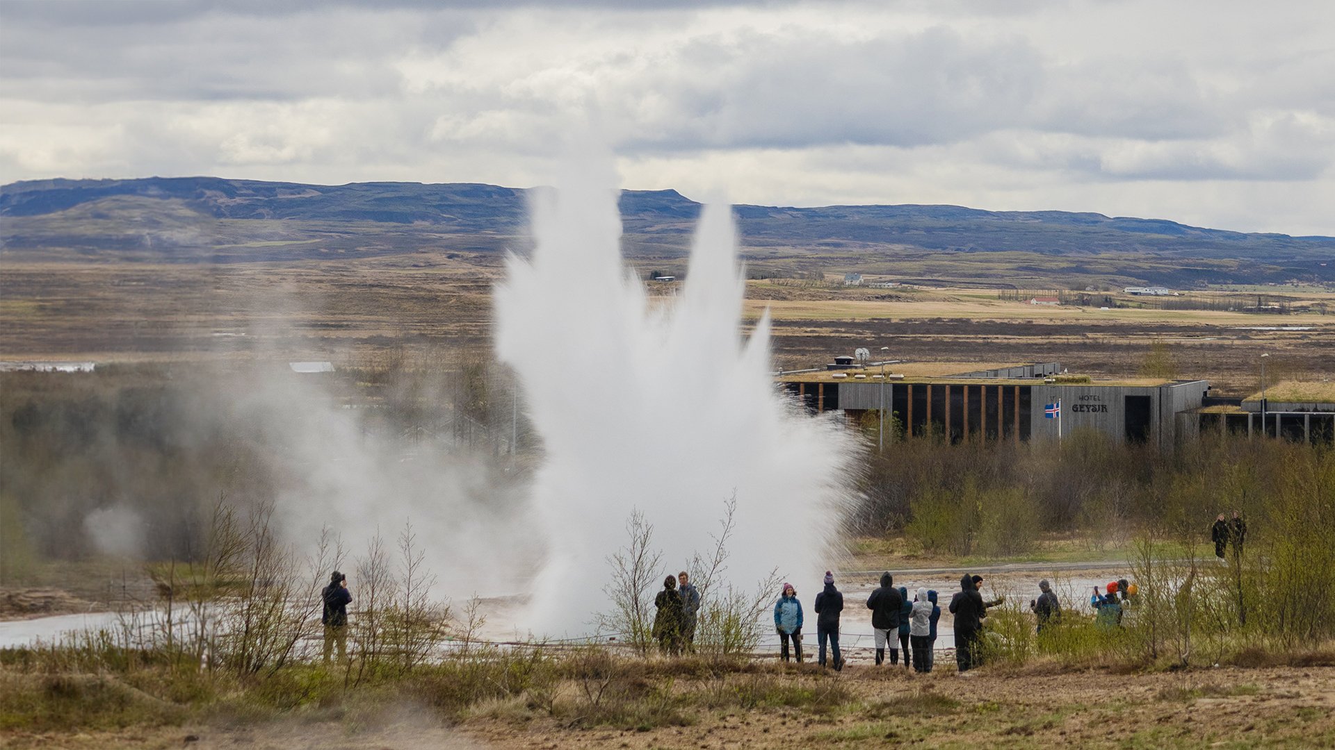
Strokkur Geyser, (on the honeypot ‘Golden Circle’ route), is currently the country’s most visited active geyser (with the largest being ‘Great Geysir’ which stopped erupting in recent years). Famed for its powerful eruptions with clockwork precision, Strokkur Geyser blasts water up fifteen to twenty metres high, every four to ten minutes, giving us a wonderful reminder of mother nature’s power.
Near the geyser, we visited Gullfoss waterfall (translating as ‘Golden Falls’), one of Iceland’s most beloved waterfalls in the Southwest. Our walk up to the waterfall took around thirty minutes, stopping on the way back to visit the Kerid Crater.
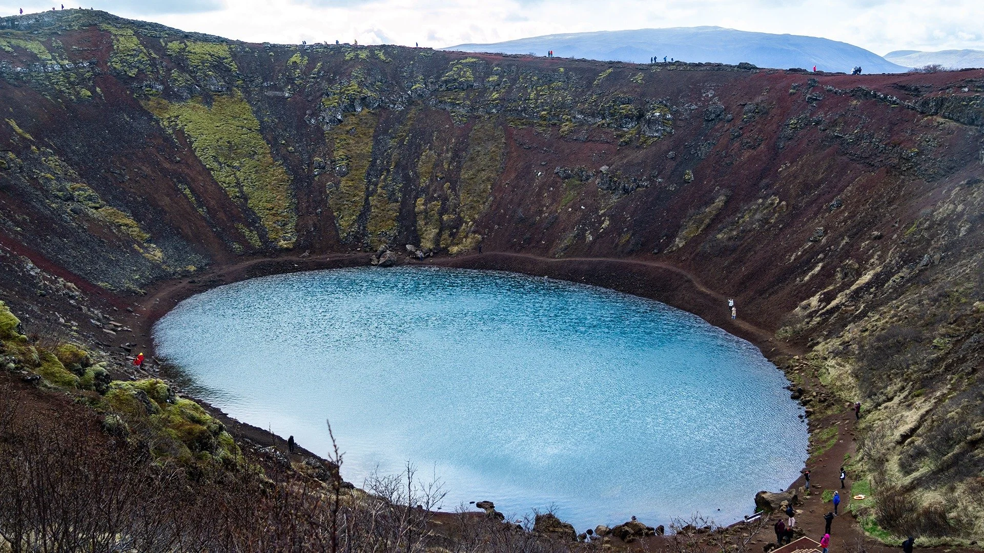
A testament to the earth and its fiery origins, Kerið, commonly known as the Kerid Crater, is another of Iceland’s distinctive Golden Circle landmarks. The 1.4km circular path provided a great way to stretch our legs while observing the spectacular panoramic views, with a staircase down to the lake offering an even closer look. At 170m wide and 270m across, its iconic black volcanic and iron-rich, ruby-red slopes fall 55m deep, creating a striking contrast against the mineral-abundant blue-green water below. Luckily, it wasn’t expecting any activity in the near future… Having once been a cone-shaped volcano, the crater is now more of a collapsed magma chamber following its last explosion 3000 years ago, (which is half the age of the majority of Iceland’s volcanic sites, dating back to 6000 years ago)!
We bid farewell to Iceland, fondly remembering her wonderfully curious and unearthly landscapes, and her spellbindingly stormy skies; yet forgiving the unforeseen cyclones, unpredictable stormy weather, unfavourable wind angles and consistently dense fog forever interfering with our plans!
Excitement filled the air as our crew geared up for the next chapter of our Arctic expedition onboard FIREBIRD… However, our upcoming passage across the Denmark Strait was anything but uneventful… stay tuned for the next episode of our Nordic adventure in GREENLAND.

