The Greenland Series Vol.2
Log 00326
WEST GREENLAND – Disko Bay North
Below you’ll find a continuation of our exploration of Western Greenland, following our previous sailing expedition around the southern end of Disko Bay.
Having reconvened our guests and crew back on the yacht, S/Y Firebird was anchored a short dinghy ride from the fishing pier of Aasiaat village (Egesdesminde). Enjoying a quick catch-up dinner together onboard, we readied ourselves to sail north this time, exploring the northern landmarks Disko Bay had on offer and with the hope of some better weather promised. Conditions permitting, we would optimally return once again back to Ilulissat, depending on the population of icebergs at the time!
Aasiaat - Kronprinsens Eijland
Departing Aasiaat (which translates as ‘spiders’ in Greenlandic but derives from the word "ausiat", meaning ‘for those in search of summer’) on another crisp, yet sunny morning, we headed back towards the natural harbour of Kronprinsens Eijland (Crown Prince Island, named after Prince Frederik VI of Denmark), which we’d already become acquainted with on our initial visit to the Epiq Sermia glacier. Being the largest island of two small archipelagos southeast of Qeqertarsuaq (Godhavn), Kronprinsens Eijland is a vast wonderland with miles of dramatic cliffs up to 600m high, as well as having been an established hub for English and Dutch whaling activities between 1781 and 1968.
A picturesque anchorage, surrounded by remnants of the ancient whalers’ lodgings against a backdrop of blue sea and distant icebergs made for a delightful lunch spot; providing us a tranquil interlude before an action-packed afternoon on the kayaks. With the evening sun casting an unfamiliar warm glow, we bid the Prince’s Island farewell and headed off for Quequertaq Bay.
Quequertaq Bay
After sailing more than 90 miles through an intrinsic network of icebergs, we anchored in the remote Quequertaq Bay on the south face of PuiagtupQaqa; a place of unparalleled beauty.
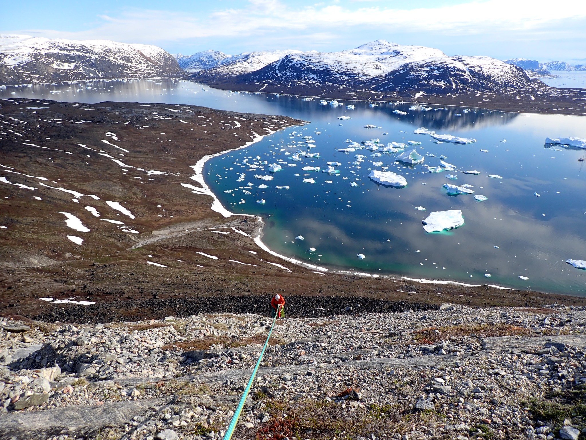
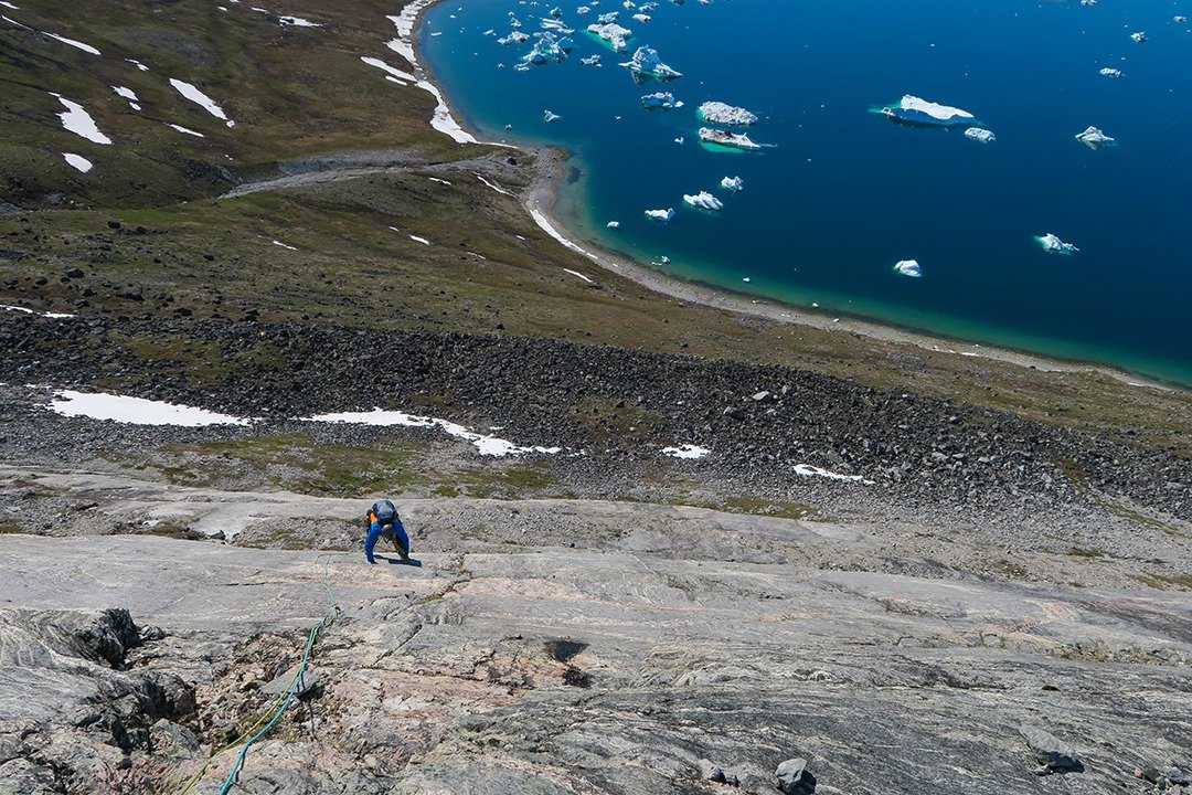
After a one-hour hike, we reached the base of our elected wall and were ready to embark on our first ascent. This initial recce gave us an idea of necessary gear and the proposed climbing conditions. Greenland was discovered as a climbing area in the early 1970s and still has many unexplored and unclimbed walls and peaks. Naming and documenting new routes is customary among climbers, we thereby christened this one - "Disko Dancing".
The bedrock we’d scrambled up stretches back nearly four billion years, with the folding, pale grey, Archean rocks all being various forms of Juliannehaab granite. The rippling or folding effect often seen across the terrain, is a direct result of Greenland’s erosive and ever mobile, inland ice. The majority of the country’s sub-continent is made of crystalline rock from the Precambrian shield, formed over several periods of mountain building, and stemming from three different mountain chains! (The Ketilids, Nagsugtoqids, and the Agpatids).
With a mix of excitement and trepidation, we made a lengthy climb of 600 metres, encompassing 13 challenging pitches which took us between 6 and 7 hours. Suspended amidst a hard grit path, there was no turning back and the only way was up! Our ascent was followed by a trek around the mountain, descending into the valley without a trail. This next phase of the journey extended our workout by 2 hours, eventually leading us to the fjord where our tender sat waiting, 2 miles from where Firebird was anchored. Exhausted but elated to be back on board, we could finally enjoy that long-awaited cup of coffee and a well-earnt hearty meal. Climbing bare rock faces like these is both nerve-wracking and physically demanding, but the sense of achievement is unmatched.
Saqqaq
A beautiful and clear approach took us towards the settlement of Saqqaq (Sarqaq), positioned just north of the previously visited Qeqertaq, in the Avannaata municipality of Western Greenland. Qeqertaq is located in the Harward Islands at the bottom of Kangerlussuaq (Inglefield Bredning) and is often referred to as "refrigerator", due to the surrounding glaciers causing the temperature to drop suddenly by several degrees… despite some beautiful sunny weather!
Founded in 1755, Saqqaq translates from Danish as ‘Sunny Side’, with reference to its ‘Livets Top’ mountain peak position making you feel as though you are on top of the world. With around 132 current inhabitants, the primary sources of income revolve around tourism and halibut fishing. The area boasts numerous archaeological discoveries associated with the Saqqaq culture: Greenland's oldest known civilisation dating from 2500 BC to 800 BC.
Dropping our anchor in Saqqaq that evening, we planned an early breakfast the following day prior to exploring the Pulateriaq Valley and intending to climb one of the local peaks...It transpired that we found ourselves scaling an iceberg!
Now, ice climbing requires a fair amount of equipment; primarily a good set of axes and crampons if you’re hoping to make much progress… and then there’s all the gear needed to protect the climb, like a good rack and anchor kit, not to mention your own 'get-up', helping you stay warm in the sub-zero climate!
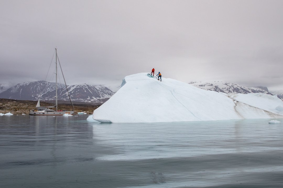
Conducting a test ascent, we focused on a modest 10-metre-high iceberg, which gave us an opportunity to practice disembarking from the tender* and to better understand the quality of the ice. (*Do note, crampons are extremely sharp and not practical when disembarking from the inflated rubber of a tender!)
A good distance from the coast and deep into the fjord nearby to our anchorage, we approached the iceberg we'd been prepping for; a colossal structure measuring approximately 40-50 metres in height and spanning an estimated 200m x 200m. Taking into account some critical considerations, we evaluated: the stability of the iceberg and its unlikeliness to roll or suddenly capsize; the quality of ice, with no cracks or broken blocks; the best access points accessible by tender; and ensured we were acting with optimal weather conditions (sub-zero air temperature, minimal to no wind, and no strong water currents).
Once we’d made it to the top of the iceberg, we walked along the flat summit before abseiling back down… only to then climb it once more again! This time, conquering an extremely vertical flat face, Certainly deserving of acknowledgement!
! Climbing Greenland’s icebergs was truly a once-in-a-lifetime experience, but here's a valuable tip: Before attempting any iceberg climb, make sure you conduct a trial climb, familiarising yourself with the equipment and potential factors that could come into play. The unpredictability of such icy terrain is an adrenaline fuelled and exhilarating ride, only to be undertaken with extreme caution and of course with a local guide who knows what they are doing. For our climbing in Greenland, we sought the guidance of climbing expert Massimo Candolini from Inmont and would recommend his expertise time and time again.
Langebugt Fjord
Heading a little further south back down the coast of Kronprinsens Eijland and anchoring at the entrance to Langebugt fjord, we took an excursion up 369m Arna, taking in some fantastic views of the islands near Ritenbenck. Jumping across the waterfalls, the sound of fresh running water was music to our ears… only to be disturbed by very few birds chattering above us. Crisp, ivory slopes still hung over sapphire blue seas, in beautiful juxtaposition to the mainland’s earthy brown terrain. Sparsely dotted with humble dwellings and the occasional arctic hare, we took numerous photos of the diverse colours and textures within Greenland’s ice sheet, all owing to the fluctuating temperatures across their vast landscape.
Now visible between the frozen ponds of ice which nestled between the mountain’s crevasses, our chosen trail had scored another excellent view of Epiq Sermia’s meringue-like glacier. The glacier is located 70 km north of Ilulissat and is one of the largest calving glaciers in all of Greenland. The easy access to the ice sheet from here, is why it was used by some of the first polar explorers in Greenland for scientific studies.
Ilulissat
Having made our way back down to Ilulissat (Jakobshavn), which lies 350 km north of the arctic circle, the haunting sight of low clouds enveloping the sea of neighbouring icebergs created an otherworldly atmosphere. Spending more time in the town of Ilulissat on this trip than our initial travels around Disko South, offered us a glimpse into Greenland’s rich history. We visited the Zion Church (Zions Kirche) which was built in the late 18th century and the largest man-made structure of its time. Ilulissat is highly populated with Greenland’s iconic and loveable huskies, which we spotted easily and heard often amid the quaint local lodgings. Here, we paused for a few days’ rest, ahead of our final expedition into the deeper north.
The Deep North
After a small break to reprovision and a changeover in guests, our expedition into the deeper north would now involve six days of sailing with approximately 400 nm. In pursuit of some final whale spotting between the icebergs, we would have the added bonus of being in remote territory. As always, our itinerary was weather dependent, with a final destination of Upernavik town, located in the vast islands of the Upernavik Archipelago, on the north-eastern coast of Baffin Bay.
The Vaigat Channel (Sullorsuaq Strait)
Venturing north from Aasiaat and around Ilulissat, we continued to sail back up through the Vaigat Channel, often referred to as the ‘Sullorsuaq Strait’ separating the Nuussuaq Peninsula from Qeqertarsuatsiaq in the south-west, and connecting Disko Bay with Baffin Bay in the north. The dull woolly skies on our passage through the channel allowed us to obtain some great shots of icebergs in the lower light. Our passage through the water was as flat as a millpond, but the waters here haven’t always been so deceivingly calm… This area saw major landslides in prehistoric times, sparking earthquakes near to the shore or underwater. This would often generate tsunamis or even ‘megatsunamis’, sometimes reaching heights of up to several hundred metres!
Appat Island
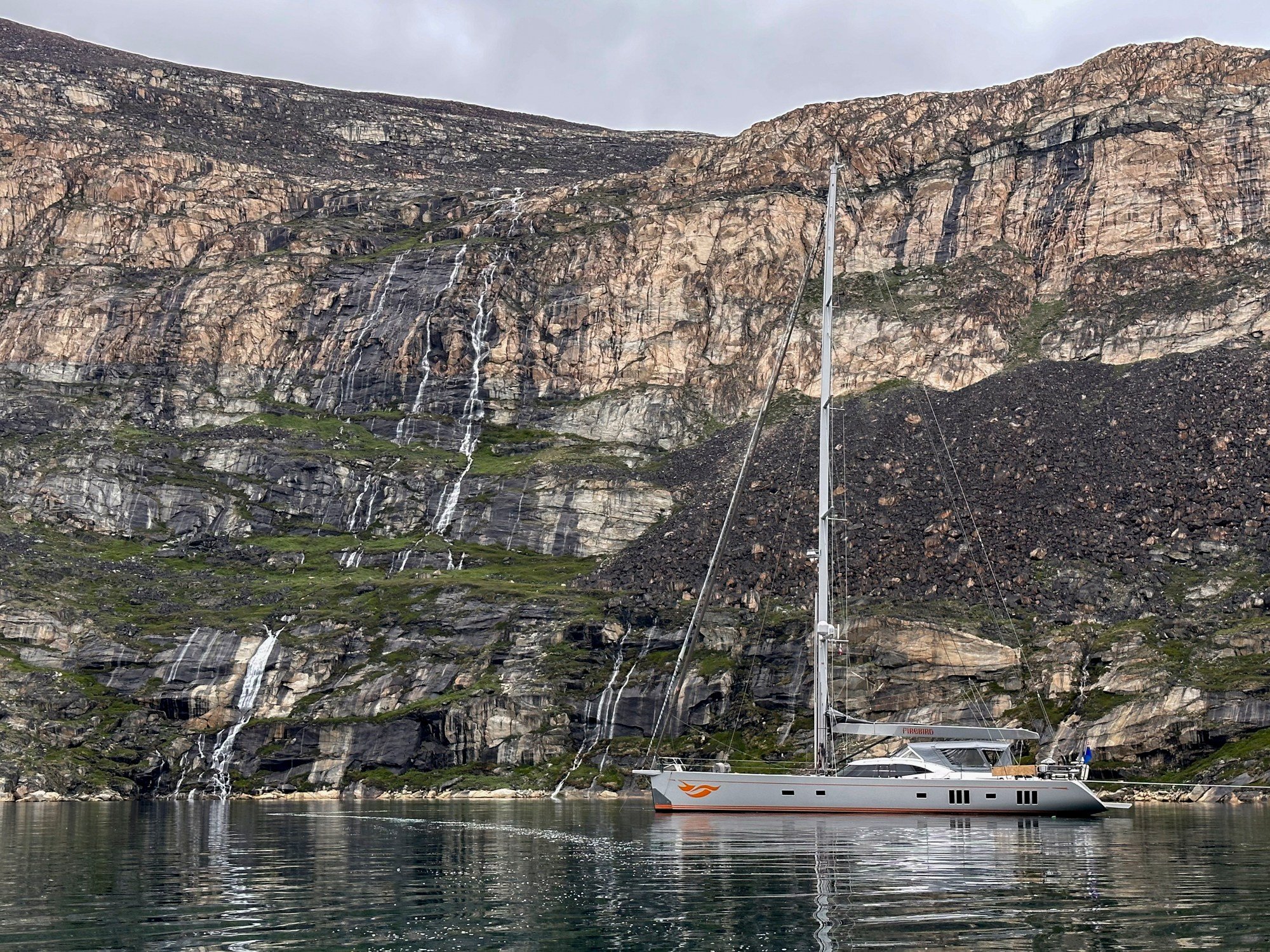
Heading up and around the corner of Disko Bay into the Uummannaq Fjord, Appat Island, (formerly known as Agpat Island) is one of Greenland’s uninhabited isles. Boasting an undeveloped coastline, it remains accessible to mountaineering enthusiasts exclusively by private boat or helicopter. We marvelled at the island’s mountainous landscape, made up of precipitous walls falling from the glaciated summit plateau in every direction; these waterfalls showering down the cliff face, cascading hundreds of metres to the sea.
As we sailed around this island scouting for possible trails and climbs, its beauty left every one of us enamoured. The highest point on the island is Appat Qaqaa (1685.9m), located in the western part of the glaciated summit plateau. Both the plateau and island mass are bisected by the Naqellorssuaq valley which runs from the north coast to the south.
Starting from sea level, we finally decided on a chosen dihedral wall climb (when two rock faces meet at an angle, creating a corner and usually involves techniques like stemming to climb). We began our arduous task after some careful preparation with bolts and expansion pitons. Abseiling down from the top, we drilled the rock face, securing bolts as we went, anchored by a rope and using only our hands and feet. The experience was totally exhilarating!! Not only did the physical exertion and endurance of this ascent give us a great sense of achievement, but the icebergs trapped within the frozen fjord below us were an incredible sight for our tired eyes. Without ever being able to fully convey our exact emotions during such a memorable accomplishment, let’s just say it was hands down, an experience we’ll never forget.
We arrived safely to our final destination of Upernavik; and with a little sadness we prepared ourselves to bid farewell to Western Greenland. Our final excursions took us to Baffin Bay, now predominantly dressed in hues of green and brown, yet remnants of the recent snow and ice persisted in fleeting glimpses. As we shed layers in the gradually warming climate, our journey continued seamlessly onto the rocky walls. The S/Y Firebird, serving as an impeccable auxiliary launch, facilitated our rock-climbing ascent with precision.
Savouring wonderful memories we will fondly remember Greenland’s ‘bipolar’ aura, both tempestuous and placid waters, encircling obtrusive and clumpy boulders of rock and ice; sparse mossy patches of terrain sprouting green between tousled and cascading waterfalls; with everything sat majestically beneath a heavy cloak of grey cloud… This is Greenland.
Qujanaq!!!

